Landscape Arch is the longest arch in Arches National Park. It is a beautiful arch with two side trails to see other arches along the way. A flat, easy hike that everyone in your family can enjoy.
How to Get There:
Located in the Devil’s Garden district, take the main road into Arches and follow it to the end of the road. You will end up in the Devil’s Garden parking area loop. On the Northwest side of the loop, you will find the trailhead for Landscape Arch, Tunnel Arch and Pine Tree Arch. Located at the trailhead are restrooms and water.
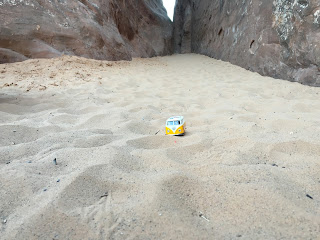
From the trailhead, you will follow a well defined trail that is quite sandy in some parts. Early into your hike, you will come to trail markers that will show you some off-shoot trails that will take you to Tunnel Arch and Pine Tree Arch. We took both of these side trails and it didn’t add any significant distance or time to our hike. Of the two side arches, we would definitely suggest going to see Pine Tree Arch. It is a neat arch that you can go right up underneath and it offers beautiful views. And if you are going to make the effort to see Pine Tree Arch, you might as well see Tunnel Arch too. Tunnel Arch you cannot get close to see because it is high up towards the top of a mountain, but the trail leads to a pretty cool view point for the arch.
 |
| Pine Tree Arch |
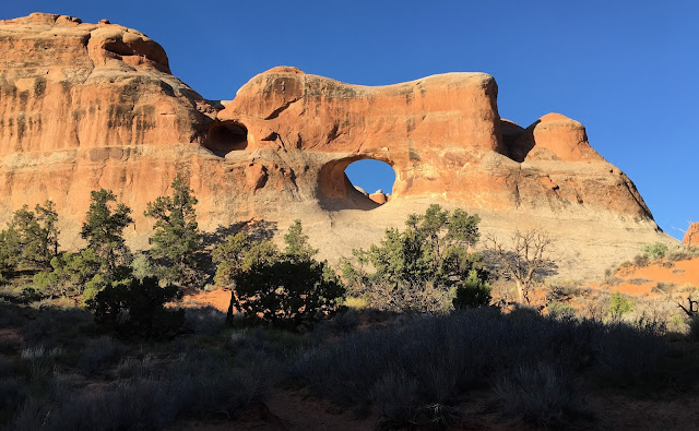 |
| Tunnel A |
Once you get back up to the main trail, Landscape Arch is easy to get to. You will stay on the main trail that is relatively flat with no major elevation changes. It is a 1.6 mile round trip hike and will take anywhere from 50-90 minutes depending on your stops and how fast your family moves.
What You Will See:
As you approach Landscape Arch, your breath will be taken away. You can see it all along the tail end of the trail. When we were hiking towards it, we didn’t know how close we would be able to get so we started taking pictures from pretty far out. They look pretty good, but we found out that you can actually get quite close to it. In the past, you were able to hike right up underneath. But there was a large collapse of part of the arch that lost quite a lot of rock all along the right side of the arch. Since then, they have closed off that part of the trail. But you can still quite enjoy the beautiful arch from a distance.
You will come to a plaque that gives information about the arch and the collapse. We thought that that would be the end of the trail but discovered that it actually winds for a little bit after that where you can get different angles and views of the spectacular arch with plenty of good photo opportunities.
We went in the relative early morning and didn’t encounter many other hikers, but as we were leaving we started seeing quite a few more heading into the hike. If you do go in the morning, make sure to bring a sweatshirt and possibly a hat and gloves because most of the hike is in chilly shadows until the sun comes up over the canyon.
Sum Up:
This is a beautiful, easy hike that allows you to see the longest arch in Arches National Park as well as two other neat arches. It is 1.6 miles round trip on a flat dirt and sandy trail. With lots of opportunities to view the arch and many different angles, there are plenty of spots for photo opportunities.


 Located in the Devil’s Garden district, take the main road into Arches and follow it to the end of the road. You will end up in the Devil’s Garden parking area loop. On the Northwest side of the loop, you will find the trailhead for Landscape Arch, Tunnel Arch and Pine Tree Arch. Located at the trailhead are restrooms and water.

 Once you get back up to the main trail, Landscape Arch is easy to get to. You will stay on the main trail that is relatively flat with no major elevation changes. It is a 1.6 mile round trip hike and will take anywhere from 50-90 minutes depending on your stops and how fast your family moves.